Mistakes Were Made - Days 8-9
Perhaps it was because I never had an issue with weather on my first trip. Or maybe I should not have set my tent under a tree. I could have planned the route the night before and used the internet to make a more informed decision. I was getting radio weather forecasts from Dallas, TX, Tulsa, OK and Little Rock, AR, which were the 3 large cities surrounding my camping location, and all said to expect late afternoon thunderstorms the next day. They said nothing about either rain overnight or weather at the top of the Ouachita Forest. Whatever the reason, I made the mistake of camping out last night, and I was miserable.
.
I started out yesterday and headed for a short scenic through the Wichita Mountains in OK.  Even though it was overcast, it was quite a pleasant drive, with nice scenery and quite a few buffalo and longhorns. The highlight was the top of Mount Scott (me?) and panoramic views on all sides.
.
After that, I started zig-zagging across the Oklahoma countryside for another scenic drive, the Talimena Scenic Byway connecting Talihina, OK and Mena, AR. The only reason this road was built was for the scenery, and every half mile or so there was a pullover with a lofty viewpoint of the Ouachita National Forest. And with the leaves just starting to turn it is certainly the right time of year to be passing through.
.
About 2/3 of the way through, and just across the Arkansas border, lies the Queen Wilhelmina  Lodge and campground, my bunk for the night. I could have stayed in the lodge, but it was only barely drizzling. Plus there were about 10 other campsites already occupied, so I went for it and mistakenly decided to camp. I should have noticed that all the other campers were in RV's or 5th wheels.
.
Having bought 2 bundles of wood at the lodge, I popped the tent open and set up camp before returning to the comfy lodge for an awful buffet dinner whose only highlight was that I didn't throw up.
.
Returning to camp, there was no precipitation; however, there was quite a bit of moisture around the campsite and a bit in my tent. The ever present cloud cover had dropped down and seemed like I could jump up and touch it. Worse was the fact that the wind had picked up and felt gale force flowing across the top of the mountains.
.
It was around 7PM and the last bit of daylight was slipping away. I had to get a fire started fast. I started with a crumpled up trail book under a pyramid of wood. I went through half a lighters worth of fluid trying to get the trail book to flame up, but it would only smolder. I went to thinner paper, and when I could get the paper to catch, the wind would put it out in seconds. Next I was inside my car lighting a torch of paper that also was no match for the wind. After setting up a wind barrier of luggage around the fire pit I was able to keep the flame going for a half minute or so by burning any spare paper I could find in the car, but the wood was no where near catching. Finally an hour and a half later, and using half a box of thin highly flammable tissue paper, I built a sustainable fire. A couple of hours later, I finished off the second bundle of wood, and wearing thermals and a couple extra layers, I snuggled in for bed.
.
I woke first around 4AM...I think it was the sound of water that made me have to pee. I unzipped the tent, stood in the small puddle that had accumulated inside the tent, and poked my head out into a fog so dense I couldn't see my car 15 feet away. Though it wasn't raining, the fog was soaking the tree above and forming large droplets that were plunking on the top of the tent. An hour later this drum like sound would wake me for good. On very little restful sleep, and reeking of campfire smoke, I packed up camp using a camper headlight (thanks Beana!) to show the way step-by-step.
.
At 6AM, in complete darkness and dense fog cover, I decided I had to get off the mountain stat. I backed the car out of the campsite, and turned to go forward and couldn't see the road through the glare of the lights on the fog. I stopped and opened the car user manuel to figure out how to turn on the fog lights for the first time and the book shows me a picture of the headlight column with the (not available on all models) fog light setting that was missing from my Pre.
.
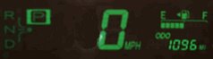
Going at a top speed of 8 MPH, I patiently followed the yellow center line down from the most miserable night I have had on all my travels. In my Top 5 list of worst nights, this is the first and only on the list.
.
With the un-restful night, I pulled over for a catnap around 7AM and decided to re-evaluate the plan for the day. I awoke with the answer, and immediately called Buz. Within 5 minutes, Buz had gone to weather.com and informed me that the only reasonable direction to go was due East along a path I have taken twice before, straight across Arkansas and into Tennessee.
The silver lining on this cloudy day was that this route took me straight past Hot Springs NP.
This smallest of parks was created around a three block row of bath houses used even by presidents for the rejuvenating powers of the natural, pure spring waters that flow from the ground. A bath, spritz, sauna, hot towel wrap and superb massage later, and I was floating out of the Buckstaff spa totally relaxed. (Interestingly, I had the same "bath attendant", Walter, as I had 3 years ago. He said he's been there since '74 and I assume if I go back again 10 years from now, he'll be my bath attendant again.) I would describe the whole process again, but I already did last time I went to Hot Springs...see this link for that post if you want more details. http://myroadtrip07.blogspot.com/2007/08/arkansas-well-blow-me-down-its-awesome.html
.
I guess the bath house cancels out the prior night's misery and that makes me about even. But I then had a really pleasant drive on the back roads of the AR and into Tennessee. I am half way through a sunny (thanks Buz) scenic drive and am comfortably holed away in a hotel in beautiful Henderson, TN. And I got to watch Survivor tonight!
.
I think I might be completely stifled as far as weather tomorrow (there may be tornadoes in the area), but at least I'll be sure to check before heading out. If by chance the weather is descent, I might try the camping out thing one more time before hitting Jersey. But I certainly won't be camping out in cold, windy, rainy, foggy, miserable weather again!
.
"Fool me once, shame on you. Fool me twice...won't get fooled again." - GWB
3 comments:
Dave Bewick showed me the weather.com radar maps that are pretty good. At weather.com, enter a city or zip and then click Radar Map in the middle of the yellow bar.
Go down below the map and click Future and watch the clouds roll by for the next 5 hours or so.
To figure out what the colors mean, click Legend on the bottom right -- yellow is #4 on a 6 shade rain scale.
Thanks Buz. I tried it out, and it will be very helpful...it tells me that I may have clearish skys for tomorrow. So I may get to do what I want...if not, will be heading home faster in bad weather.
Post a Comment